Our Vision
Using modern technology for the public service to provide an effective service for all.
Our Mission
Uplifting the lives of the community through providing services, effective coordination of resources and effective planned,sustainable development process with government polices.
HISTORY OF THE DIVISION
This village is historically been important place and, as in the legend the name of the village “Medagama” has been formed because of the middle of hills. It is said that this village which was one of colony that King Sadhdhathissa created was called “UYANTHOTA” at that time. History says that King Dutugemunu was stationed at Uyanthota during the Rajarata liberation movement from Ruhuna. Medagama was known as “MALGASTHALAWA” in the 1870s as a place where the ancestors of the 1818 rebellion was living.
Villagers say that at that time there was no main road in Medagama - Monaragala and the construction of the Bibila - Monaragala road took place in 1915 and the location of the school, hospital etc. was inhabited.
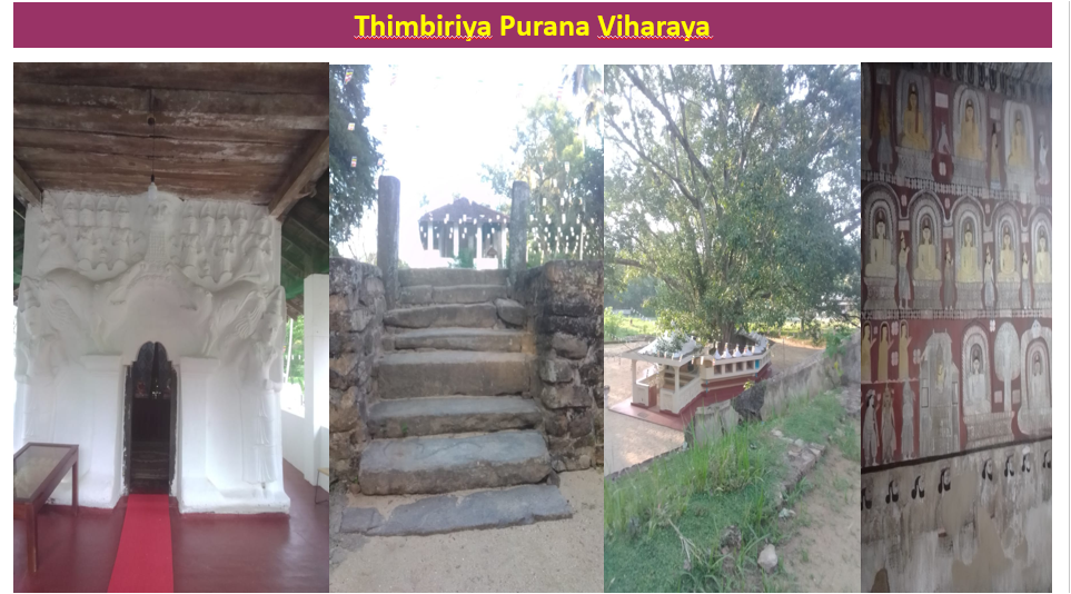
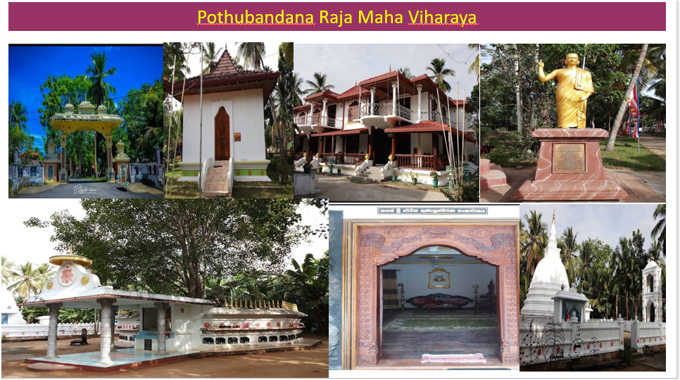
And also there are many historical Temples in the Medagama divisional secretariat that inherits such a history. Among them, are the Pothubandana Raja Maha Viharaya, Thibiriya purana Viharaya, Ahugoda purana Viharaya, Thabana Devagiri Viharaya, and Bibilamulla purana Viharaya.
LOCATION
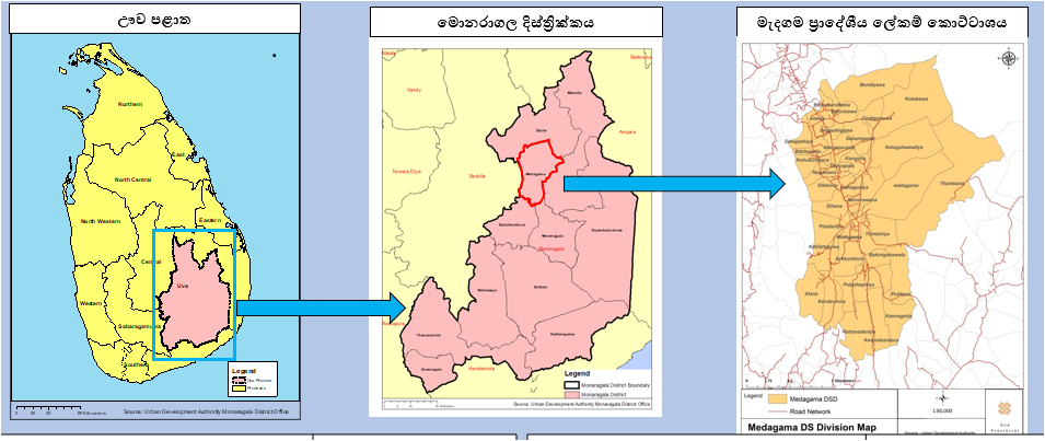
The Medagama Divisional Secretariat Division is located in the Uva Province, within the Monaragala District, bordering the Badulla District on its northwestern boundary.Covering an area of 245.14 square kilometers (or 23,500 hectares), it represents about 4.2% of the total land area of the district.According to its absolute location, it lies between Greenwich coordinates 195–215 north and 216–265 east.
In terms of relative location, it is bordered by
Bibila Divisional Secretariat Division to the north
Madulla Divisional Secretariat Division to the east
Badalkumbura and Monaragala Divisional Secretariat Divisions to the south
Badulla District to the west.
Situated at an elevation of approximately 700 feet above sea level, the Medagama Divisional Secretariat Division comprises 35 Grama Niladhari divisions, which together include 121 villages. It falls under the Bibila electoral division.
(Source: Land Use Planning Division – Monaragala)
TOPOGRAPHY AND SOIL CHARACTERI STICS OF MEDAGAMA
The Medagama Divisional Secretariat Division, located within an isolated mountainous region, exhibits a diverse topographical structure extending between 500 and 2,500 feet above mean sea level. The division is naturally bordered by mountain ranges along its western, northern, and southern boundaries, forming distinct physiographic limits.
The mountain ranges within the division, with elevations ranging from 1,500 to 2,500 feet, are predominantly V-shaped, steep, and rugged in appearance. The overall landscape features a combination of flat terrain and undulating highlands, creating significant variation in topographic relief.
The mountainous zone encompasses several Grama Niladhari Divisions, including Senapathiya, Bibilamulla, Kohukumbura, Nugamura, Ellekona, Alhena Pitadeniya, and Kinnarabowa. The highest triangulation point in the division is situated in the Alhena Grama Niladhari Division, reaching an elevation of approximately 2,850 feet above sea level. Prominent isolated hills within the division include Girapola (2,227 ft) and Gonidowa (2,388 ft).
An important geomorphological observation is that approximately 60% of the total land area consists of flat terrain, characterized by slopes within the 0–8% range. The overall slope distribution of the division can be categorized as follows:
0–8% (flat terrain)
8–16% (gently undulating)
16–32% (moderately sloping)
32–60% (steep)
Above 60% (very steep)
Areas with slopes exceeding 60% are mainly concentrated in the Bibilamulla, Kohukumbura, Nugamura, Ellekona, Badiyawa, Kinnarabowa, Thambana, and Kalugahawadiya Grama Niladhari Divisions.
Regarding soil distribution, approximately 90% of the total land area is covered by Reddish Brown Earth (RBE) soils, which are well-suited for both annual and perennial crop cultivation. In addition to the two main categories of RBE soils, minor areas of alluvial soils (associated with river valleys) and erosion-prone soils (associated with mountain slopes) are also present.
The soil composition of the Medagama Division can be summarized as follows:
45% Reddish Brown Earth with low humus content (clayey texture)
45% Reddish Brown Loam soils
5% Wetland soils associated with paddy cultivation and drainage areas
5% Erosion-prone soils along elevated slopes
These characteristics collectively indicate that the Medagama Divisional Secretariat Division is a region of considerable topographic diversity and soil fertility, offering potential for varied agricultural and land-use planning initiatives
ROLE PERFORMED AT DS
| NO |
Name |
Post | From | To |
| 01 |
N.H.Pathirana |
Revenue Officer | ||
| 02 |
L.H.Bandusena |
Revenue Officer | ||
| 03 |
D.D.T.Jayawardana |
Assistant government agent | ||
| 04 |
P.H.P.Premasiri |
Assistant government agent | ||
| 05 |
D.P.L.C.Perera |
Deputy Government Agent | ||
| 06 |
T.M.Abayawicrama |
Deputy Government Agent | ||
| 07 |
A.Kulathunga |
Divisional Secretary | ||
| 08 |
S.Lokugamage |
Divisional Secretary | ||
| 09 |
D.D.Piyadasa |
Divisional Secretary | ||
| 10 |
P.B.Amarasekara |
Divisional Secretary | ||
| 11 |
A.H.K.J.Chandasiri |
Divisional Secretary | ||
| 12 |
Gunadasa Samarasinhga |
Divisional Secretary | 2002.11.25 | 2006.12.31 |
| 13 |
K.S.K.Wallahewa |
Divisional Secretary | 2007.01.01 | 2011.06.02 |
| 14 |
K.H.A.K.Nishantha |
Divisional Secretary | 2011.06.03 | 2015.11.30 |
| 15 |
G.U.K.Algewaththage |
Divisional Secretary | 2015.12.01 | 2017.12.27 |
| 16 |
K.M.G.K.Bandara |
Divisional Secretary | 2017.12.28 | 2025.01.04 |
| 17 |
D.M.P.R.Dissanayaka |
Divisional Secratary | 2024.01.05 | Present |